

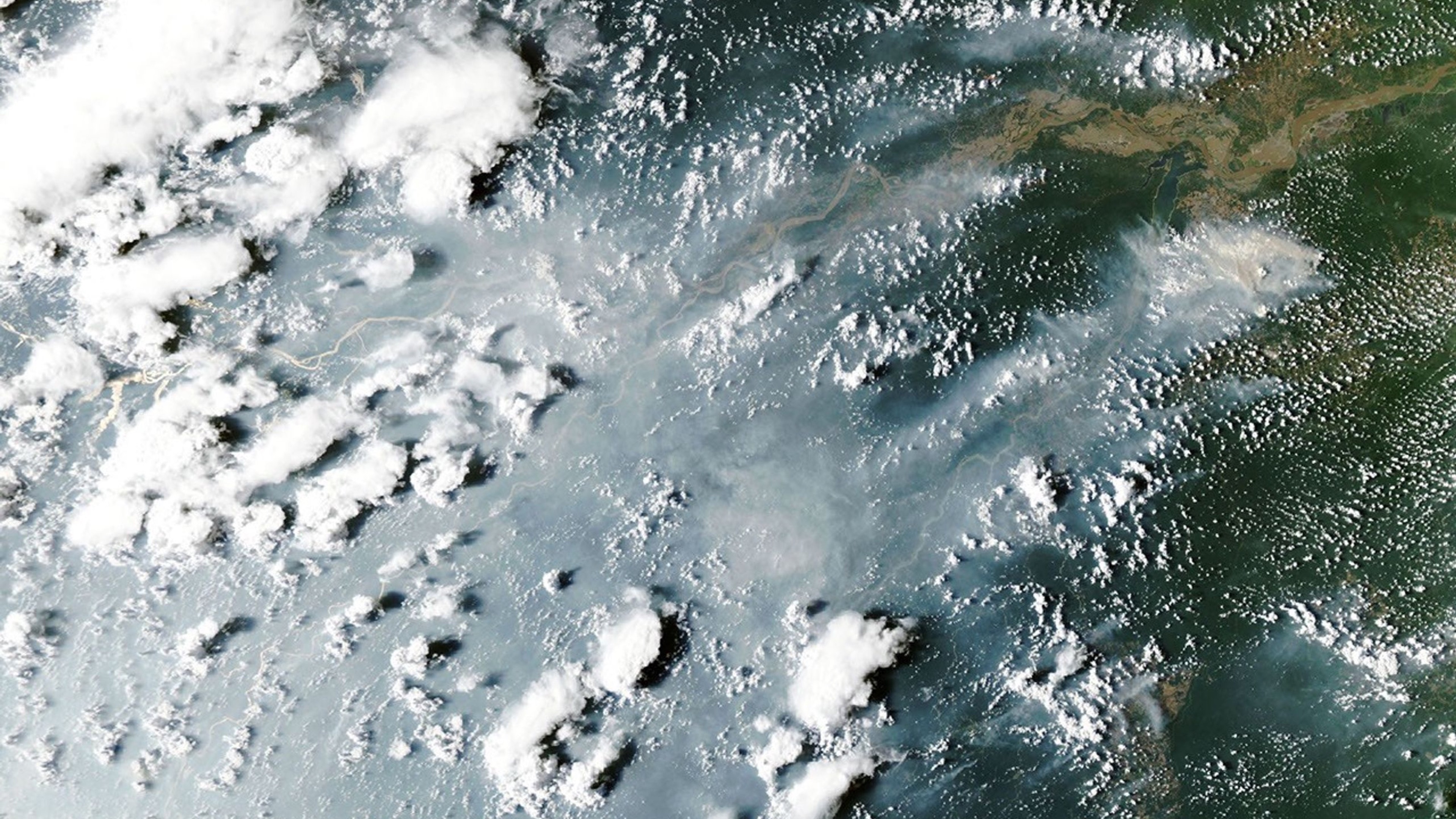
Smoke blankets Manaus: NASA satellite shows Amazon fires spreading
Aqua imagery from 12 October and analysis published on 15 October link increased fire activity to drought during El Niño.
NASA published a satellite-based account of fires in the central and eastern Amazon on 15 October. Its Aqua satellite recorded smoke on both sides of the Amazon River on 12 October. Air quality deteriorated in Manaus, a major Brazilian city. The image date and publication date are different: the observation was made on the 12th, while the new NASA report appeared on the 15th.
NASA researchers say drought associated with El Niño has set the stage for a long, severe fire season. That does not mean the climate pattern ignited the forest by itself. Scientist Douglas Morton explains that many fires begin with human clearing burns and then escape into dry forest undergrowth.
Satellite imagery shows the scale but can miss smaller fires hidden by clouds, smoke and canopy. Researchers estimate 50 to 70 uncontrolled fires in the Santarém area. Their outlook for the coming months is a forecast, not a report that those future fires have already happened. Residents should follow local air-quality and safety notices.
Cover image: NASA Earth Observatory / Lauren Dauphin, MODIS data from NASA EOSDIS LANCE and GIBS/Worldview.
Source: https://science.nasa.gov/earth/earth-observatory/fires-arrive-in-the-amazon-rainforest/
If you have found a mistake or a typo in this article, tell us about it
Comments (0)
Log in to leave a comment →
No comments yet. Be the first.