

Thailand floods seen from space: NASA’s new images show water spread across farmland
NASA released a satellite comparison on 9 October showing flooded land beside Thailand’s Bang Pakong River. The newer image was taken on 2 October, after weeks of rain. We explain what its false colours reveal and why it is not a live map of conditions today.
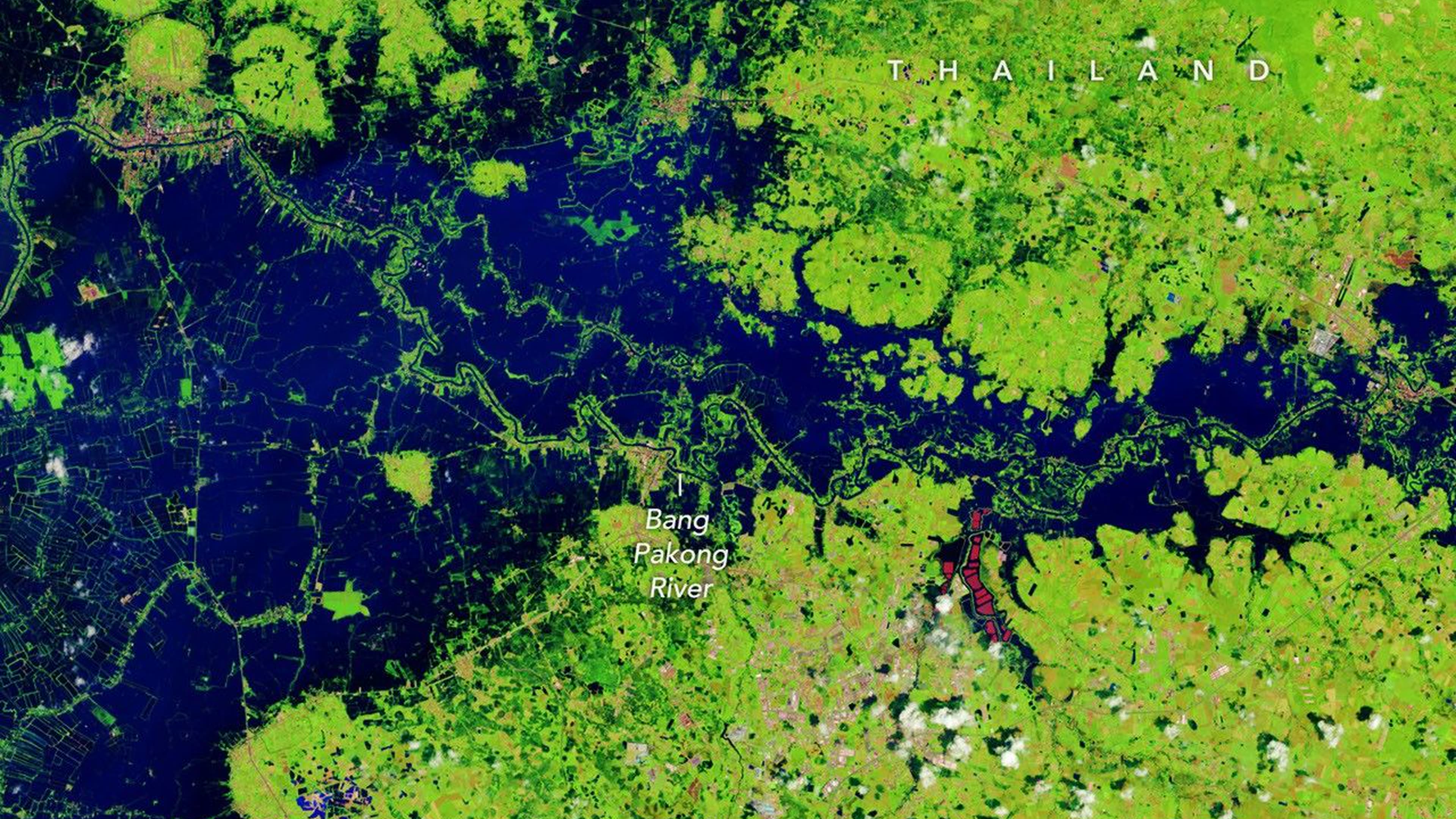
NASA Earth Observatory published satellite images of flooding in Thailand on 9 October. A Landsat image from 2 October shows inundated low-lying land, farmland and aquaculture areas beside the Bang Pakong River in Prachin Buri province. NASA compares it with an image of the same area from October 2025.
Reading the image
The colours are enhanced: water appears dark blue and vegetation bright green. This makes the extent of flooding easier to distinguish from fields and built areas. It is not a conventional natural-colour photograph, but a useful tool for mapping change.
Heavy rainfall has affected Thailand since mid-September. Citing humanitarian estimates, NASA says flooding has affected many provinces and millions of people. The satellite frame records one place on 2 October; it cannot establish water levels everywhere on 9 or 10 October.
Current local warnings and road information are essential for residents and travellers. NASA’s value here is a wider, independent view of where water spread and a way to compare the landscape across time.
Source: official announcement.
Photo: NASA Earth Observatory / Lauren Dauphin; Landsat image acquired 2 October 2026. https://science.nasa.gov/earth/earth-observatory/floodwaters-overwhelm-thailand/
If you have found a mistake or a typo in this article, tell us about it
Comments (0)
Log in to leave a comment →
No comments yet. Be the first.