

NASA images thick haze over Pakistan and explains what trapped pollution near the ground
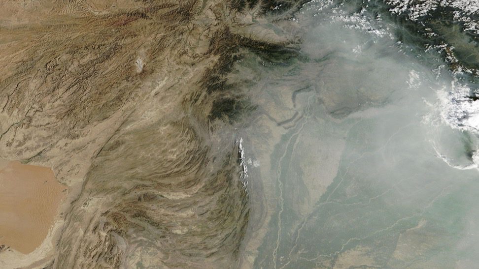
NASA’s Terra satellite captured dense grey haze over northern Pakistan on 24 September. The agency points to crop fires, dust, traffic, industry and a temperature inversion that acts like a lid, trapping polluted air close to where people live and breathe.
What the satellite saw
On 27 September, NASA published an image of northern Pakistan acquired by the Terra satellite on 24 September. A broad grey veil of aerosols — fine particles suspended in the atmosphere — covered plains and cities.
Scientists list several possible sources: smoke from crop fires, dust from the Thar Desert, vehicle exhaust, industry, construction, fireworks and household fuel burning. One satellite image cannot precisely separate each source, but it can reveal the scale and movement of the haze.
Why the air does not clear
A temperature inversion changes the normal structure of the atmosphere. A warmer layer sits above cool surface air and acts like a lid: vertical mixing weakens, allowing particles to accumulate at the level where people live and breathe.
Terrain can reinforce the effect. Cold air descends from the Tibetan Plateau and mixes with polluted air over the plains, while light winds may be unable to disperse the dense veil quickly.
What observation from space adds
MODIS on Terra captures a large region at once and complements ground air-quality sensors. A satellite does not replace street-level concentration measurements, but it helps track fires, dust plumes and haze boundaries where monitoring stations are sparse.
Source and image: MODIS Land Rapid Response Team, NASA GSFC.
If you have found a mistake or a typo in this article, tell us about it
Comments (0)
Log in to leave a comment →
No comments yet. Be the first.