

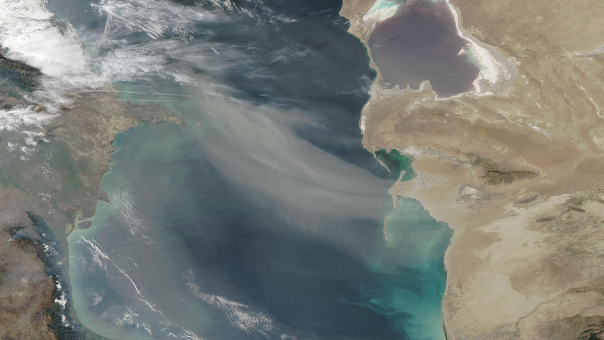
NASA Image Shows Dust Storm Over the Caspian Sea: What Aqua Actually Recorded
NASA’s Aqua satellite captured broad dust plumes crossing the Caspian Sea on September 24. The agency published the true-color image and placed it within a period of strong winds. We explain what the image confirms, what it cannot establish, and why satellite observations matter.
What the satellite showed
NASA has published an image of broad dust plumes over the Caspian Sea. The MODIS instrument aboard the Aqua satellite acquired it on September 24, and it appeared in the mission’s official gallery on September 26. It is a true-color image: long pale bands show dust being carried over the water.
The frame includes the eastern Caspian coast, the Kara-Bogaz-Gol lagoon and the western side of the sea. The plume stretches from the east and southeast toward the central basin. Clouds in the west appear brighter white and more structured, while the dust is gray-beige and partly translucent.
What is known about the weather
NASA’s description says Kazhydromet had warned of southeasterly wind gusts of 15–20 meters per second and dust storms from the night of September 23 through the evening of September 24. The satellite acquisition falls within that period.
The image confirms the presence and broad extent of airborne dust at a particular moment. It does not measure surface wind speed or reveal sea conditions at every location. Ground observations, weather models and reports from services on site are required for those conclusions.
Why causal claims require caution
NASA also refers to the tragedy during military exercises in Kazakhstan’s part of the Caspian and describes the sudden adverse weather as one factor under preliminary consideration. The satellite image alone cannot establish why people died. An official investigation must consider the participants’ actions, equipment, local waves, wind and other conditions.
The responsible conclusion is therefore limited to what is securely observed: a large dust plume covered a substantial part of the Caspian on September 24, and a strong-wind warning had been issued beforehand.
Why these images matter
MODIS data allows researchers to observe a process across a large region, including areas with few ground stations. Meteorologists, environmental researchers, aviation and maritime services can use it to reconstruct events and test aerosol-transport models.
The image is reproduced for informational reporting under NASA’s media usage guidelines. Image credit: MODIS Land Rapid Response Team, NASA GSFC. The frame was cropped to 16:9 without altering its content.
If you have found a mistake or a typo in this article, tell us about it
Comments (0)
Log in to leave a comment →
No comments yet. Be the first.